Bridging Design and Data: How Bridlepath Photography Supports the AEC Industry Through Precision 3D Modeling
The Architecture, Engineering, and Construction (AEC) industries are undergoing a digital transformation. The era of hand-measured drawings and static floor plans is giving way to intelligent, data-rich 3D environments that power every stage of a project — from early design to post-construction management.
At Bridlepath Photography, we’ve embraced this future. Using advanced 3D imaging and spatial capture technology, we create high-accuracy digital models that integrate seamlessly into BIM (Building Information Modeling) and CAD (Computer-Aided Design) platforms.
Our mission is to give architects, engineers, contractors, and facility managers the most reliable visual and dimensional data possible, so they can plan, design, and build with confidence.
From Space to Data: How We Capture Precision
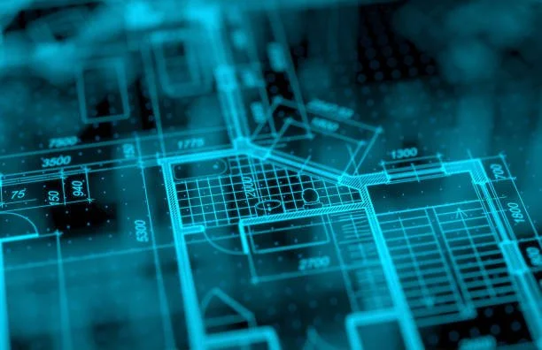
Our 3D capture process begins with a detailed on-site scan that records every dimension, surface, and spatial relationship. Each scan produces a comprehensive point-cloud dataset and textured 3D model with measurement accuracy within a few centimeters — ideal for use in architectural design, engineering coordination, and facility documentation.Once processed, this data is exported through the Bridlepath cloud workflow into formats that are fully compatible with BIM and CAD software, including Revit, AutoCAD, ArchiCAD, Rhino, and SketchUp.
The result is a high-fidelity digital twin of your space — not just a visual walkthrough, but a measurable, data-ready model that can serve as a foundation for design, coordination, and long-term building management.
Deliverables Designed for the AEC Workflow
We understand that every discipline in the AEC sector uses spatial data differently. That’s why our 3D deliverables are created to meet the needs of a wide range of professionals:
For Architects and Designers
Generate floor plans, elevations, and section drawings directly from accurate 3D data.
Use our models as the as-built foundation for renovation or expansion projects.
Visualize design concepts in a fully dimensioned environment, minimizing field rework.
For Engineers
Leverage precision measurements to coordinate mechanical, electrical, and plumbing (MEP) systems.
Import the model into analysis tools to perform structural, civil, or environmental assessments.
Ensure all disciplines align spatially through verified, high-accuracy geometry.
For Contractors and Construction Managers
Use data-rich models to plan site logistics, verify as-built conditions, and track progress.
Simplify communication with clients and subcontractors using 3D visualizations and annotated tours.
Reduce errors through clash detection and pre-construction coordination in BIM environments.
For Facility Managers and Building Owners
Maintain accurate digital records for maintenance, inspection, and future renovations.
Share realistic 3D models with service providers for remote assessment and planning.
Use the model as a living digital reference throughout the building’s lifecycle.
Whether you’re at the concept stage or managing post-occupancy operations, Bridlepath Photography’s 3D capture provides the clarity and confidence that modern projects demand.
Data Accuracy: The Foundation of Every Decision
In the AEC industry, accuracy isn’t a luxury — it’s a requirement.
A measurement error of just a few centimeters can translate into costly rework, coordination delays, and structural conflicts.
That’s why every Bridlepath 3D scan is calibrated to meet stringent accuracy standards suitable for architectural and engineering applications. Our scanning technology records millions of data points per room, with typical dimensional accuracy within ±1% to ±2% of scale depending on site conditions and range.
This level of precision ensures that:
MEP systems can be coordinated accurately in BIM.Construction teams can trust the data when planning installation or fabrication.Floor plans align perfectly with real-world geometry.
Our workflow also includes quality checks and alignment verifications before final delivery, ensuring that every dataset is consistent, complete, and ready for integration into your software ecosystem.
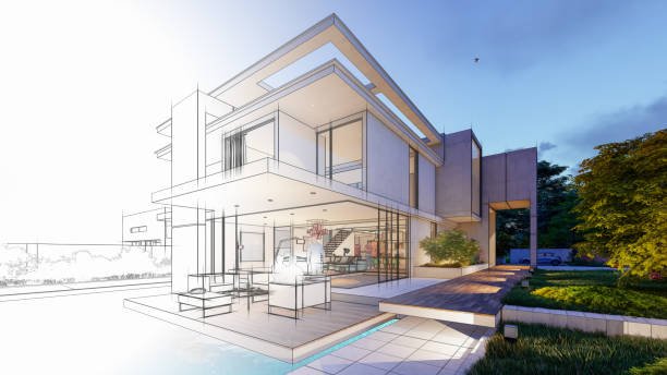
The Value of a Digital Twin
What makes Bridlepath’s 3D capture so powerful isn’t just the visuals — it’s the intelligence embedded within them.
Each model we produce functions as a digital twin: a spatially accurate, data-rich replica of the built environment.
This model can evolve alongside your project, serving as:
A planning reference during design development.
A coordination model during construction.
A maintenance record after handover.
Clients, investors, and project teams can explore the model interactively, measure distances, view details, and attach notes or tags directly within the environment. It transforms static documentation into a living, collaborative tool.
Reducing Time, Cost, and Risk
Traditional surveying and manual site measurements are time-intensive and prone to inconsistencies. Our 3D scanning workflow eliminates these inefficiencies, reducing time on site while increasing confidence in the results.
With Bridlepath Photography, you can:
Cut down site documentation time by up to 70%.
Eliminate return visits for missed measurements.
Streamline collaboration across teams using a shared, visual reference.
Reduce costly construction errors caused by incomplete or outdated drawings.
By providing a comprehensive, measurable model early in the project, we help clients save time, mitigate risk, and improve coordination across the entire lifecycle.
Safe, Professional, and Scalable
Working within operational facilities, construction sites, and sensitive environments requires care and professionalism. Our media and scanning technicians are trained to work under strict safety, security, and confidentiality protocols.
We coordinate with site managers, conduct clearance checks, and operate discreetly to avoid disruption.
From small architectural spaces to industrial sites exceeding 100,000 square feet, our workflow scales effortlessly to handle projects of any complexity.
Integrating Visual Media With Technical Data
What sets Bridlepath Photography apart is our ability to blend creative visualization with technical precision.
Our team combines architectural photography expertise with 3D data capture, producing deliverables that are both analytically accurate and visually compelling.
This dual capability means your model doesn’t just inform — it impresses. It’s a tool for engineering coordination and for stakeholder presentations. You can use the same dataset to plan HVAC systems and to wow clients with a photorealistic virtual tour.
Building a Smarter Future for the AEC Industry
As cities evolve and projects become more complex, the AEC industry’s demand for accurate digital documentation continues to grow.
Bridlepath Photography stands at the intersection of technology and craftsmanship — helping professionals build smarter, faster, and more sustainably through accurate, data-driven imagery.

Our clients include architectural firms, engineering consultancies, general contractors, developers, and facility management teams who rely on our models to enhance collaboration and deliver excellence at every stage of the project lifecycle.If your firm is ready to transition from static documentation to interactive, BIM-ready 3D data, Bridlepath Photography has the tools, technology, and expertise to make it happen.
Ready to Bring Intelligence and Accuracy to Your Next Project?
Contact Bridlepath Photography today to schedule a consultation or request a demo of our 3D scanning and modeling services.
Whether you’re designing, engineering, building, or maintaining — our mission is to help you see, measure, and manage your project with precision.
Because in the modern AEC landscape, data drives decisions — and accuracy builds trust.
October 29, 2025